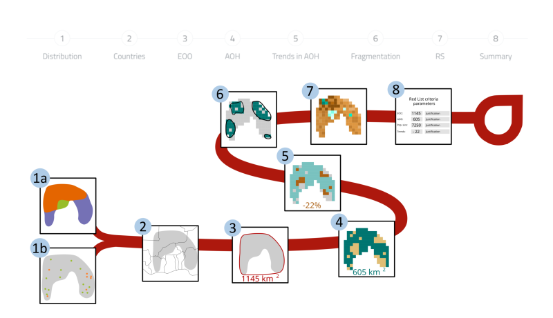
Creates a distribution from online available or uploaded occurrence data
Maps species Area of Habitat and calculating trends in Area of Habitat
Extracts Countries of Occurrence of the species
Calculates trends in forest cover in species' range
Calculates population severe fragmentation
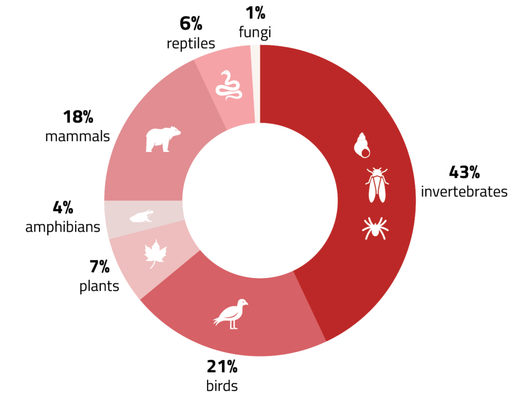
A focus on biodiversity
Platform usage at a glance
Data collected up to June 2026
5,014
unique species
9,515
assessment runs since October 2023
3,835
assessment runs in 2025
857
unique users
Latest updates
A new version was released in August (v1.7) with several new features to support marine assessments, to explore generation length, to filter occurrence records from their basis of occurrence, or to compile maps from multiple species to prepare a workshop. You can see more in this new video
sRedList is now officially contributing to Red
Listing!
Real World impact and adoption
Supporting Global & National Conservation
16% of platform usage was for National
Red List assessments from 23 countries.
Cited in 120 published assessments and 279 in preparation
Scientific contribution in mapping support,
calculation of area of habitat and estimate
of population size.
A tool for university teaching
Used in 5+ university sessions, 100+
assessments initiated during teaching
sessions.